
Find your parcel, see it on the map, keep it in your basket.
Find your parcel in Türkiye using the public parcel-query data of TKGM (the Turkish Land Registry and Cadastre), see its boundary on a satellite map, and look back through the satellite archive to see how the land changed over the years.
Download on the App Store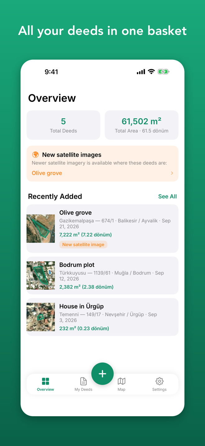
Why Tapu Sepeti?
Find your parcel easily
- Pick the province, district and neighbourhood, then enter the block (ada) and parcel number
- Type an address to find the nearest parcel
- Search by latitude/longitude, or tap any point on the map
- On the land? "Parcel at my location" looks it up with one tap
All your deeds in one place
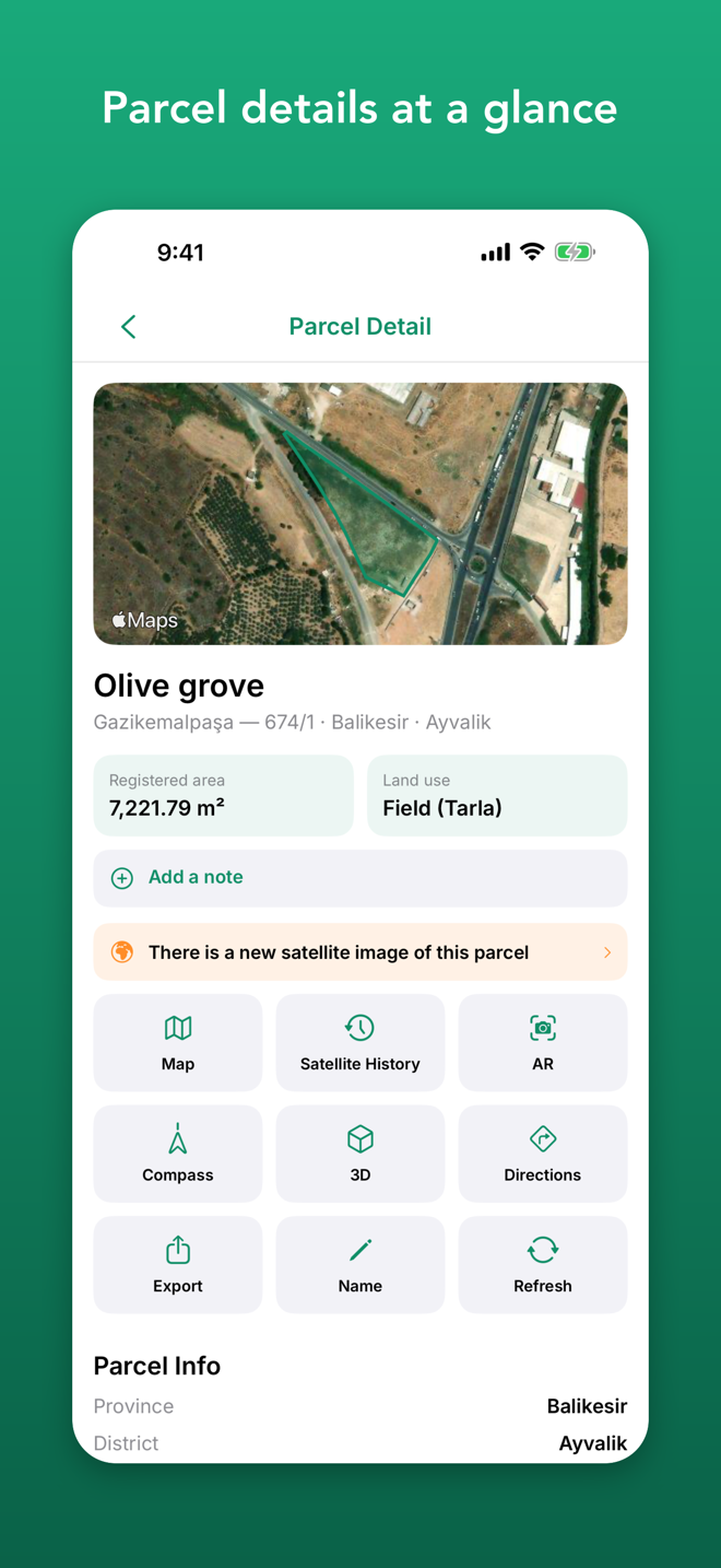
- Save parcels, give them names like "Village field" and add notes
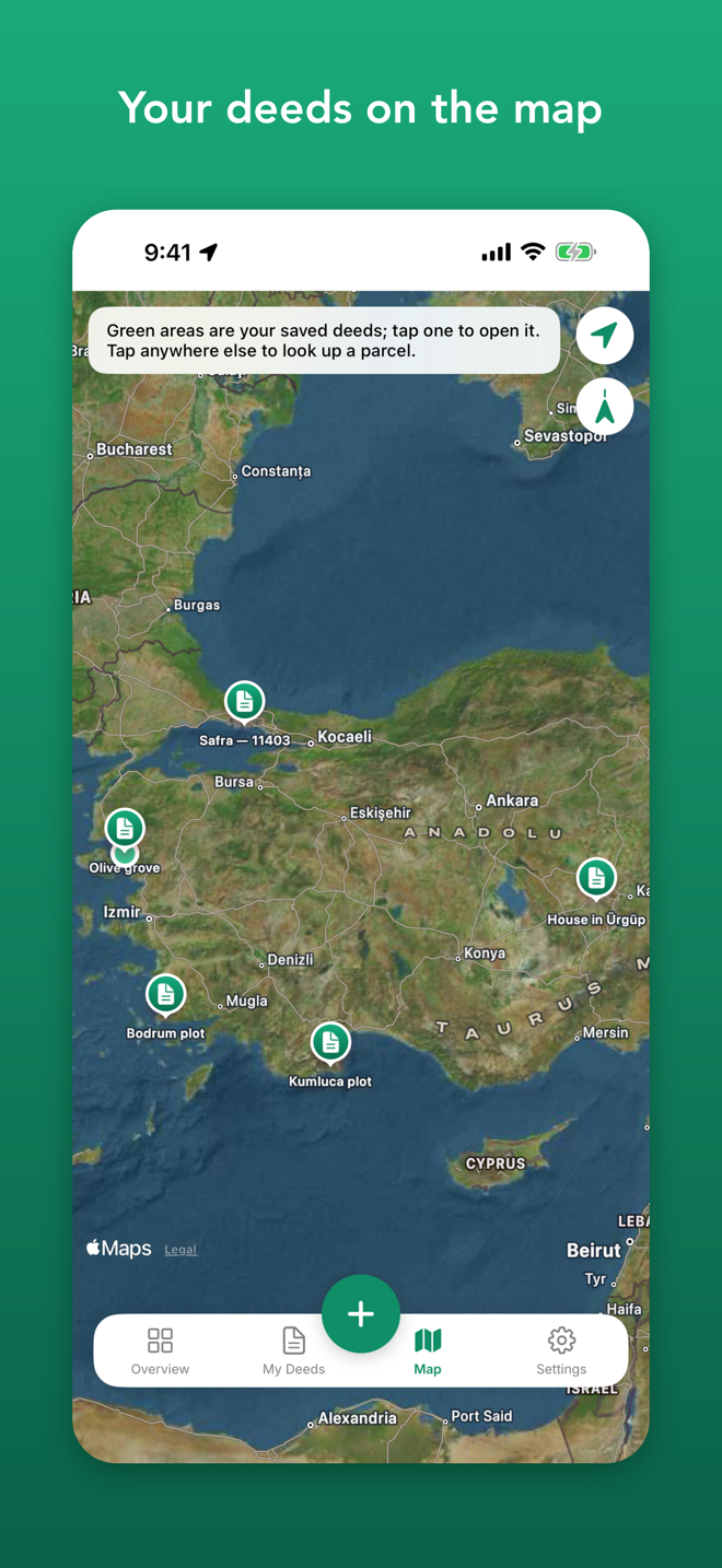
- See your deeds in a list and together on the map, with a total-area summary
- Export them all as one KML/GeoJSON file
- Parcels you look up are kept on your device and open without internet
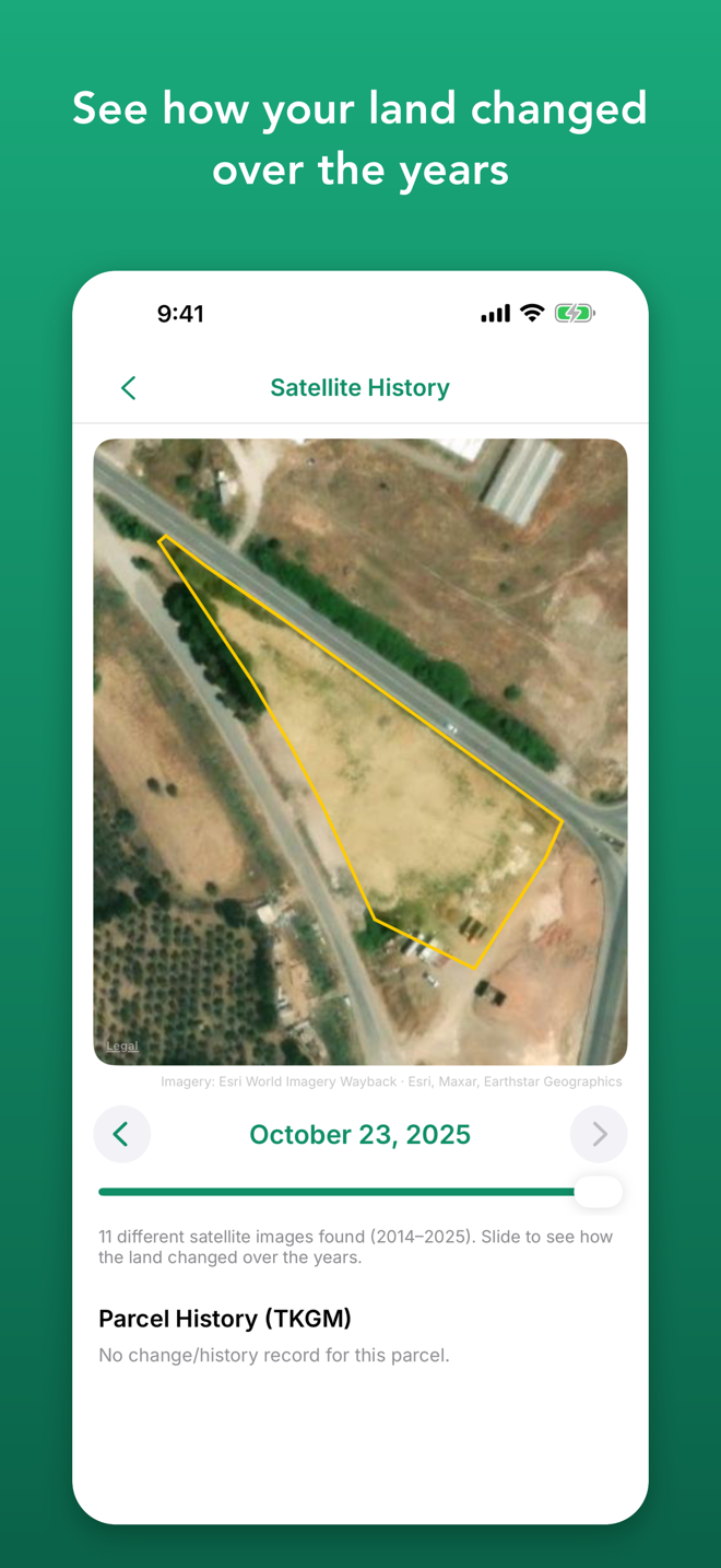
Satellite history
- Scan satellite images taken on different dates and see how the land changed
- The parcel boundary is drawn on every image
- Get told when newer imagery is published where your saved deeds are
Find your way on site
- Boundary and numbered corner points on a satellite map
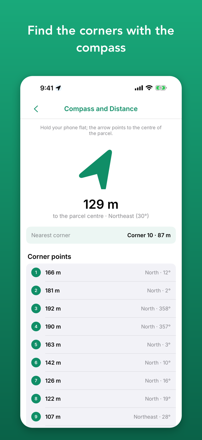
- Compass: direction and distance to the centre and corners
- See the corner points approximately in AR on phones with precise location
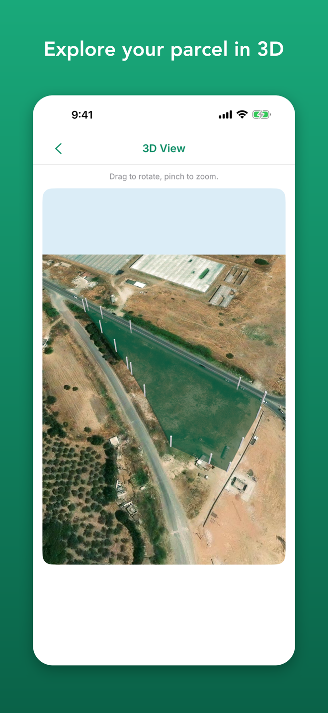
- 3D view and directions in Apple Maps
Privacy first
- No account, no ads, no tracking
- Your saved deeds stay on your device
- Turkish and English
4 Tabs, One Basket
Overview
Deed count, total area, new satellite imagery and recent additions
My Deeds
Your saved deeds, sorted by name, area or date
Map
All your deeds on a satellite map; tap to look up a new parcel
Settings
Language, export, cache, privacy and support
Important
Tapu Sepeti shows public parcel-query data from TKGM (Tapu ve Kadastro Genel Müdürlüğü). It is not affiliated with TKGM or any government agency. Information is for reference only and must not be used for official procedures. Locations, compass and AR views are approximate. Satellite history imagery comes from Esri World Imagery Wayback (Esri, Maxar, Earthstar Geographics).